Category Archives: Web GIS

New Journal article

Our article “Exploring Historical Australian Expeditions with Time-Layered Cultural Maps” has been published in IJGI and is available online:

Website: https://www.mdpi.com/2220-9964/12/3/104
PDF Version: https://www.mdpi.com/2220-9964/12/3/104/pdf

Exploring Historical Australian Expeditions with Time-Layered Cultural Maps

The Australian Time Layered Cultural Map platform was created to help digital humanities scholars investigate how online geospatial tools could provide exemplars to their humanities colleagues on how historical collections and cultural data could be extended and re-examined with geospatial tools. The project discussed here investigated how Recogito/TMT could effectively extract spatial and temporal data from pure text-based historical information and generate time-layered interactive maps of that spatio-temporal data using accessible and user-friendly software. The target audience was humanities scholars relatively new to geospatial technologies and relevant programming systems. The interactive maps were created with two free, open-source web applications and one commercial GIS (Geographic Information System) mapping application. The relative pros and cons of each application are discussed. This paper also investigates simple workflows for extracting spatiotemporal data into RDF (Resource Description Framework) format to be used as Linked Open Data.

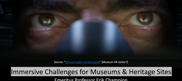
Immersive Challenges for Museums & Heritage Sites

I will give a talk tonight via Zoom to UniSA IVE colleagues on the above topic.

Time: 4PM

2022 IVE Research Seminar Series

Please join our next IVE Seminar.

Presenter:


Prof. Erik Champion

Enterprise Fellow, UniSA Creative


Title:

Immersive Challenges for Museums and Heritage Sites


Abstract:

This talk will cover recent and persistent challenges facing museums, practical issues with the implementation of virtual reality, games and gamification, and some case studies exploring potential solutions, particularly in the area of cultural heritage.

Bio:

Erik Champion is currently Enterprise Fellow (Architecture, Creative) at the University of South Australia; Emeritus Professor at Curtin University; Honorary Research Professor at ANU; and Honorary Research Fellow at UWA. He was recently a chief investigator on 4 Australian Research Council grants, Curtin University’s first UNESCO Chair (of Cultural Visualisation and Heritage) and Visualisation theme leader and Steering Committee member of the Curtin Institute for Computation. 

https://people.unisa.edu.au/Erik.Champion

Date & Time: 5 April 2022 (Tuesday) 4pm (Adelaide ACST — Australian Central Standard Time UMT +9 hours 30 minutes)

Where: Zoom

3D, Maps and DBPedia

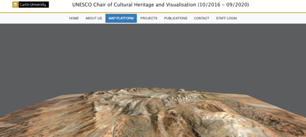
The UNESCO Chair of Cultural Heritage and Visualisation (10/2016 – 09/2020) project at https://unesco-chv.curtin.edu.au will be shut down in June 2022.

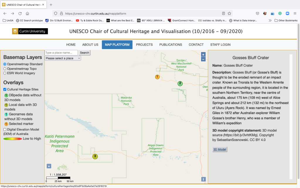
Before then feel free to look at the online Australian map platform with 3D models, Linked Open Data, DBpedia, open data etc… https://unesco-chv.curtin.edu.au/mapplatform but please allow 20-30 seconds for some of the larger 3D models to load.

It was developed for Ikrom Nishanbaev’s PhD project, (supervised with Dr David McMeekin), the thesis by publication has just been successfully reviewed.

Thank you to Ikrom, David, the GIS and cultural heritage people who provided feedback and the reviewers.

Interesting to note Ikrom started the PhD in humanities then when I left Curtin University he moved to Science and Engineering. So it is arguably a truly interdisciplinary Digital Humanities project.

One of his papers received an award. The papers are listed at:

New article (open access)

A Web GIS-Based Integration of 3D Digital Models with Linked Open Data for Cultural Heritage Exploration

by Ikrom Nishanbaev Ear Zow Digital and David A. McMeekin

Nishanbaev, I., Champion, E., & McMeekin, D. A. (2021). A Web GIS-Based Integration of 3D Digital Models with Linked Open Data for Cultural Heritage Exploration. ISPRS International Journal of Geo-Information, 10(10), 684. https://www.mdpi.com/2220-9964/10/10/684

In recent years, considerable efforts have been made by cultural heritage institutions across the globe to digitise cultural heritage sites, artifacts, historical maps, etc. for digital preservation and online representation. On the other hand, ample research projects and studies have been published that demonstrate the great capabilities of web-geographic information systems (web-GIS) for the dissemination and online representation of cultural heritage data. However, cultural heritage data and the associated metadata produced by many cultural heritage institutions are heterogeneous. To make this heterogeneous data more interoperable and structured, an ever-growing number of cultural heritage institutions are adopting linked data principles. Although the cultural heritage domain has already started implementing linked open data concepts to the cultural heritage data, there are not many research articles that present an easy-to-implement, free, and open-source-based web-GIS architecture that integrates 3D digital cultural heritage models with cloud computing and linked open data. Furthermore, the integration of web-GIS technologies with 3D web-based visualisation and linked open data may offer new dimensions of interaction and exploration of digital cultural heritage. To demonstrate the high potential of integration of these technologies, this study presents a novel cloud architecture that attempts to enhance digital cultural heritage exploration by integrating 3D digital cultural heritage models with linked open data from DBpedia and GeoNames platforms using web-GIS technologies. More specifically, a digital interactive map, 3D digital cultural heritage models, and linked open data from DBpedia and GeoNames platforms were integrated into a cloud-based web-GIS architecture. Thus, the users of the architecture can easily interact with the digital map, visualise 3D digital cultural heritage models, and explore linked open data from GeoNames and DBpedia platforms, which offer additional information and context related to the selected cultural heritage site as well as external web resources. The architecture was validated by applying it to specific case studies of Australian cultural heritage and seeking expert feedback on the system, its benefits, and scope for improvement in the near future.